


Voting District 1474980000001, St. Clair County, Michigan
About
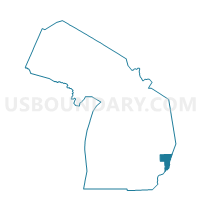
Outline

Summary
| Unique Area Identifier | 599482 |
| Name | Voting District 1474980000001 |
| County | St. Clair County |
| State | Michigan |
| Area (square miles) | 36.07 |
| Land Area (square miles) | 35.72 |
| Water Area (square miles) | 0.34 |
| % of Land Area | 99.05 |
| % of Water Area | 0.95 |
| Latitude of the Internal Point | 43.11180420 |
| Longtitude of the Internal Point | -82.93598090 |
Maps


Graphs
Select a template below for downloading or customizing gragh for Voting District 1474980000001, St. Clair County, Michigan


Neighbors
Neighoring Voting District (by Name) Neighboring Voting District on the Map
- Voting District 0871190000001, Lapeer County, MI
- Voting District 0873296000001, Lapeer County, MI
- Voting District 0874030000001, Lapeer County, MI
- Voting District 1471082000001, St. Clair County, MI
- Voting District 1472596000001, St. Clair County, MI
- Voting District 1475638000001, St. Clair County, MI
- Voting District 1515138000001, Sanilac County, MI
- Voting District 1517550000001, Sanilac County, MI
Top 10 Neighboring County Subdivision (by Population) Neighboring County Subdivision on the Map
- Mussey township, St. Clair County, MI (4,206)
- Imlay township, Lapeer County, MI (3,128)
- Emmett township, St. Clair County, MI (2,654)
- Brockway township, St. Clair County, MI (2,022)
- Burnside township, Lapeer County, MI (1,864)
- Goodland township, Lapeer County, MI (1,828)
- Speaker township, Sanilac County, MI (1,483)
- Lynn township, St. Clair County, MI (1,229)
- Maple Valley township, Sanilac County, MI (1,221)
Top 10 Neighboring Unified School District (by Population) Neighboring Unified School District on the Map
- Imlay City Community Schools, MI (12,127)
- Yale Public Schools, MI (11,279)
- Capac Community School District, MI (8,785)
- Brown City Community School District, MI (5,284)
Top 10 Neighboring State Legislative District Lower Chamber (by Population) Neighboring State Legislative District Lower Chamber on the Map
- State House District 81, MI (95,883)
- State House District 83, MI (88,414)
- State House District 82, MI (88,319)
Top 10 Neighboring State Legislative District Upper Chamber (by Population) Neighboring State Legislative District Upper Chamber on the Map
Top 10 Neighboring 111th Congressional District (by Population) Neighboring 111th Congressional District on the Map
Top 10 Neighboring Census Tract (by Population) Neighboring Census Tract on the Map
- Census Tract 6572, St. Clair County, MI (5,601)
- Census Tract 6551, St. Clair County, MI (5,212)
- Census Tract 3300, Lapeer County, MI (3,701)
- Census Tract 9711, Sanilac County, MI (3,597)
- Census Tract 3390, Lapeer County, MI (3,128)
- Census Tract 6581, St. Clair County, MI (2,648)
Top 10 Neighboring 5-Digit ZIP Code Tabulation Area (by Population) Neighboring 5-Digit ZIP Code Tabulation Area on the Map
- 48444, MI (9,327)
- 48097, MI (5,499)
- 48416, MI (5,002)
- 48014, MI (4,256)
- 48022, MI (2,654)
- 48454, MI (1,324)